Google Maps for iOS adds easy access to traffic and transit info


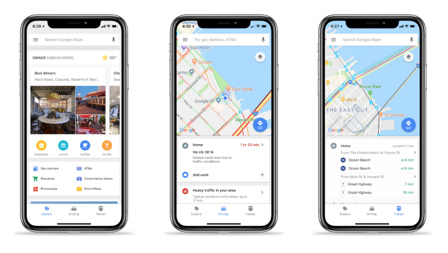
Over a year ago, Google updated its Maps app for Android, making it easier for users to search for restaurants, check out nearby traffic and find public transit schedules. Today, that update is now available for iOS users. With the update, Google Maps users will see three options on the bottom of their screens -- explore, driving and transit.
Tapping the explore tab will bring up dining options nearby as well as photos, a description of the area you're currently in and options to search for gas stations, ATMs, convenience stores, pharmacies and other locations. The driving tab gives you a summary of the traffic situation in your area including an estimate as to how much time ongoing delays might add to your drive. If your home and work addresses are saved in Google Maps, it will also give you real-time ETAs for those destinations. Lastly, the transit tab provides estimated bus and train schedules at stations near your location.
The update is rolling out today.
Via: The Verge
Source: Google
via Engadget RSS Feed "http://ift.tt/2o9gJTF"
Comments
Post a Comment